The City’s own plan put a flood-fighting pond on this field
Last updated: October 2, 2026
In brief
In 2017, the City proposed a stormwater pond on the north half of Cheney Field to slow and clean runoff from more than 460 acres upstream. Of 199 projects in its watershed plan, it ranked second among those on public land.
Two large sewer trunk lines, about 6½ and 7 feet across, run beneath the field toward Atlanta Avenue, where our neighborhoods flood. In the City’s own 2024 model of conditions before the new Peoplestown vault, even a two-year storm, one with a 50% chance in any given year, pushed water in the trunk lines just downstream above ground level in places.
The Atlanta Track Club now proposes a 175,000-square-foot building on that same ground, and has said it would move the two trunk lines to make way for it. Moving pipes this size would be a major construction project in its own right, and its route has not been made public.
The City picked this ground for a pond
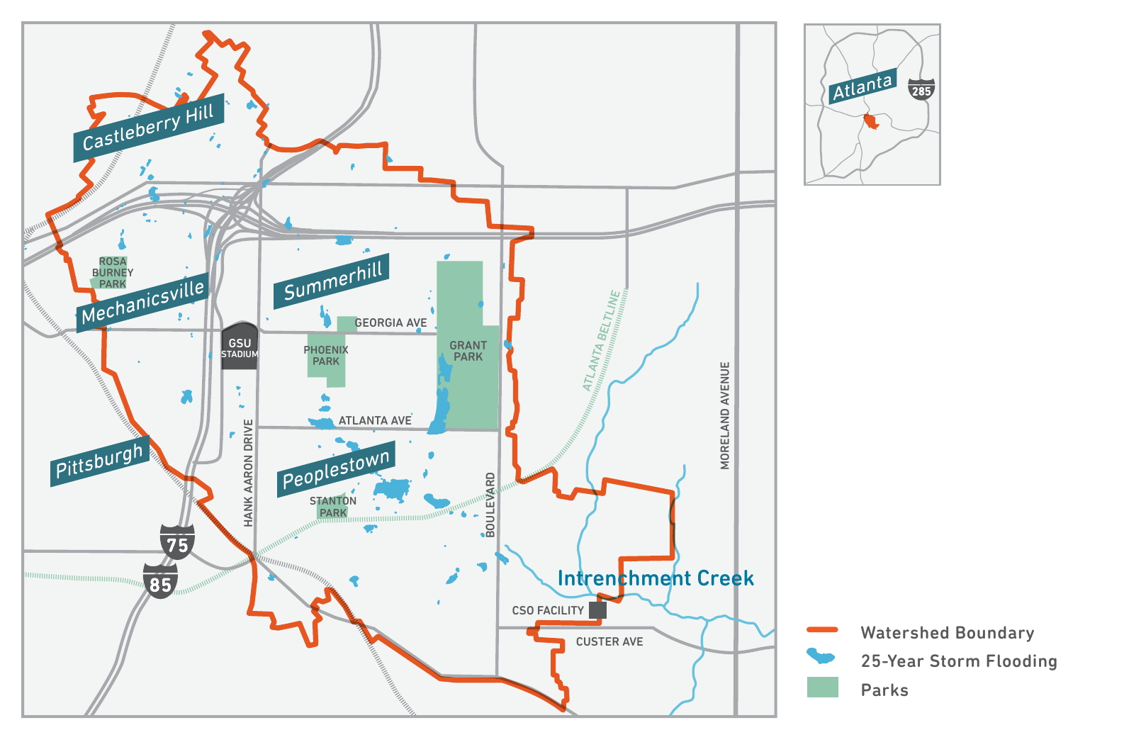
In 2017, the City’s Intrenchment and Sugar Watershed Improvement Plan, prepared for the Department of Watershed Management (DWM), proposed a new stormwater pond on the north half of Cheney Field, between Ami and Connally Streets, south of Georgia Avenue. It was designed to catch, slow and clean the runoff from more than 460 acres upstream, at an estimated cost of $3.3 million. Of the 199 projects the plan identified across the Intrenchment and Sugar Creek watersheds, it was the second-highest-scoring project on public property.
Figure 1. The City’s proposed stormwater pond (project IN-9283), outlined in blue on the north half of Cheney Field. Source: City of Atlanta Department of Watershed Management, Intrenchment and Sugar Watershed Improvement Plan, 2017.
That answers the question people reasonably ask: how much can one field matter? This one matters because of where it sits. It is the low ground the water already runs toward.
It was not the first or last time the City looked here. In 2014 and 2015, DWM was planning “a combined sewer vault under Cheney Field,” according to the Park Pride vision plan for Summerhill’s parks. In 2024, its engineers modeled new storage pipes 8 to 12 feet wide running down Connally Street, alongside the field, before settling on a design that connects the trunk lines to the new Peoplestown vault at South Avenue. Every time the City’s water planners have looked at this ground, they have seen open land that could help.
Why this field
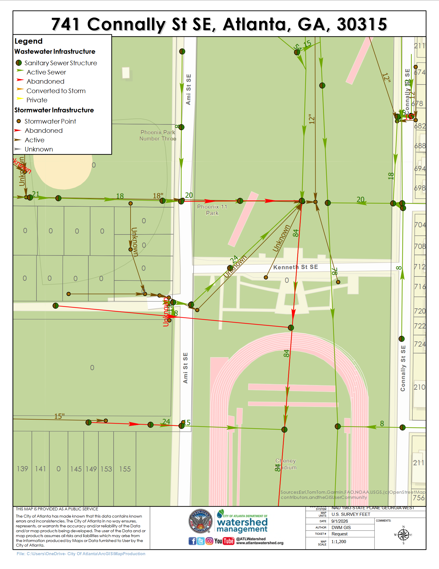
One pillar of the answer to the flooding that has beset Summerhill and Peoplestown for decades is more green space that acts as a water sponge. Two 78–84” (6.5–7 feet in diameter) City of Atlanta drainage and sewer trunk line pipes run north to south down the center of Cheney Field, as deep as 30 feet underground.
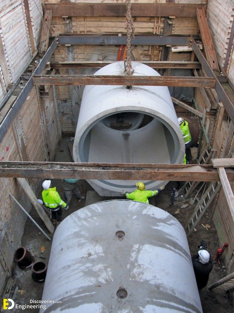
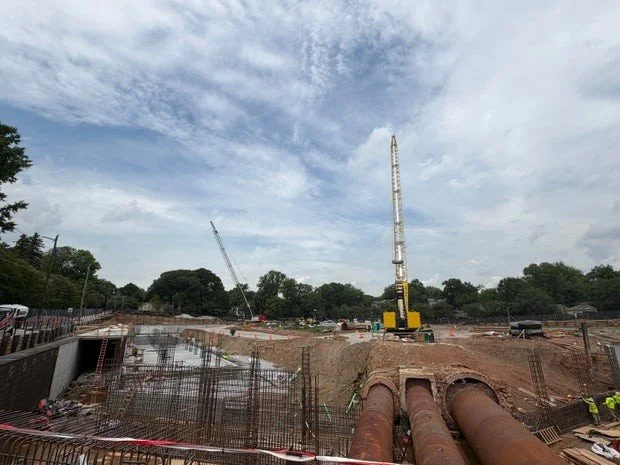
Figure 2. Workers guide a large concrete sewer pipe into a trench. The trunk lines beneath Cheney Field are similar pipes. This is not the Cheney Field site. Photo: Engineering Discoveries.
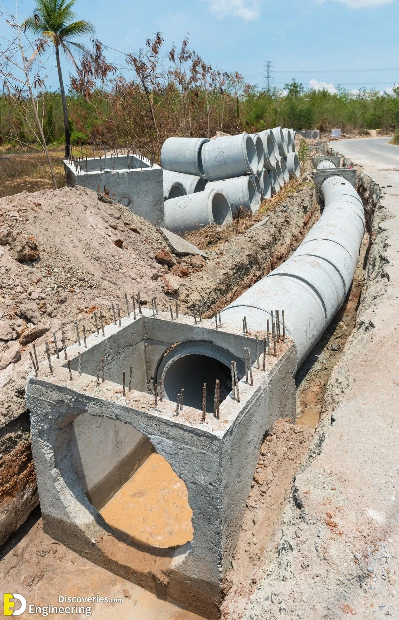
Figure 3. A line of similar concrete pipe laid in an open trench, with concrete junction boxes. Moving the trunk lines beneath Cheney Field would mean work like this, at far greater depth. This is not the Cheney Field site. Photo: Freepik, via Engineering Discoveries.
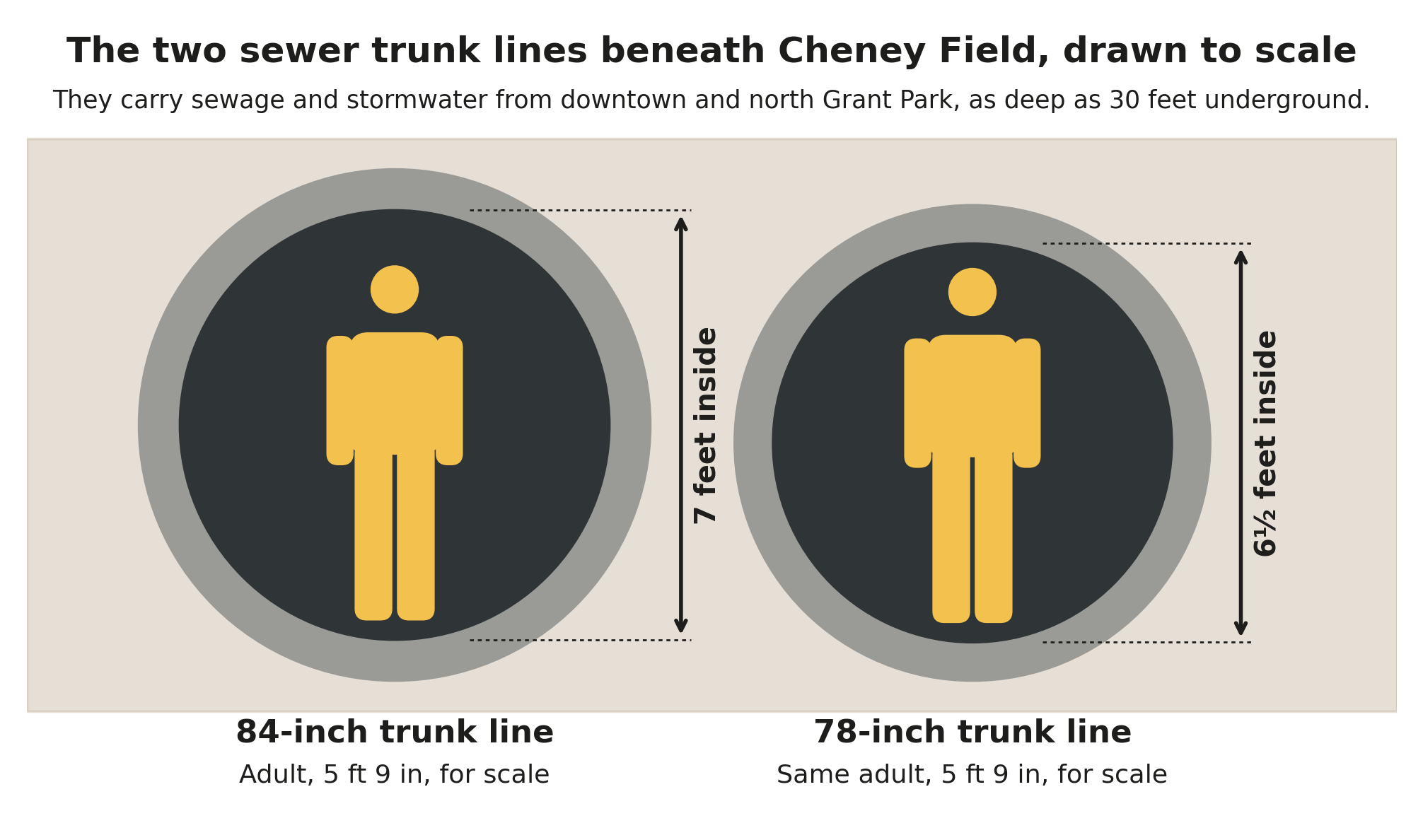
Figure 4. The two trunk lines beneath Cheney Field, drawn to scale. Graphic: Keep Cheney Green.
These combined sewer pipes service both sewage and rainwater. They begin north of Cheney Field, in downtown Atlanta and in north Grant Park, and follow old creek channels that naturally formed as water flowed southward from the higher elevation upper watershed region, present-day downtown Atlanta, to the lower elevation plain in Peoplestown. Today, this upper watershed region is highly built up, resulting in heavy stormwater flow through the pipes and over built land. Engineers who studied the watershed for the Intrenchment Creek One Water Management Plan found that the Summerhill basin has the largest connected paved area in the entire watershed, and that “the main issue in this watershed is not stormwater volume, it’s velocity.” Water from the paved uplands fills the pipes first, leaving water in the lowlands with nowhere to go.
Under Cheney Field, the trunk lines run roughly parallel, traveling south toward Peoplestown. Just south of the field, at Atlanta Avenue, they meet the Crew Street and Loyd Street trunks, a junction the One Water plan describes as “consistently plagued with flooding and combined sewer surcharge.” The flooding on and around Atlanta Avenue that we neighbors know well is directly attributable to these stormwater flows.
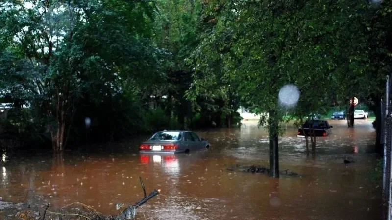
Photo: Peoplestown flooding, 2016, courtesy of South River Watershed Alliance, as published by Canopy Atlanta and Capital B Atlanta.
“They haven’t done anything to capture the stormwater at the source.”
Neighbors downstream have lived with this for decades. “The city is responsible for the flooding that’s in Peoplestown because of them not doing the proper infrastructure,” Peoplestown resident Columbus Ward told Canopy Atlanta and Capital B Atlanta this year.
Cheney Field, upstream on the same pipes, is one of the few places left where that could still happen.
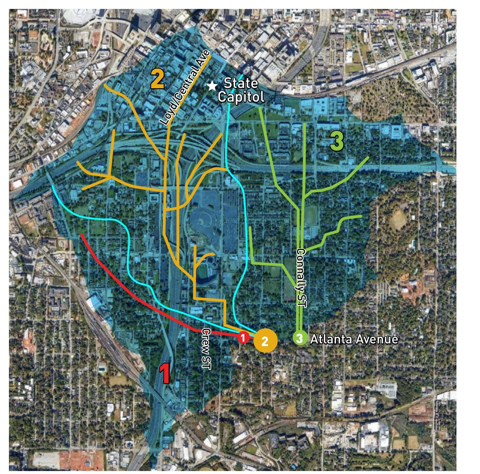
Cheney Field is one of a few precious parcels of permeable green space directly on the historic channel routes of the Intrenchment Creek watershed. The trunk lines beneath it are part of a watershed infrastructure that looks increasingly outdated with every storm. Although the exact age of all their parts is unknown, some could date back to the late 19th century, and there is a substantial likelihood of their needing repair in the near future. Our concern is that burying them under impervious concrete would be taking a leap in the wrong direction.
Figure 5. Three sub-basins and three trunk lines meeting at Atlanta Avenue. Cheney Field lies along the green Connally Street line. Credit: Intrenchment Creek One Water Management Plan, 2020.
Vaults alone will not solve the problem
The City has invested heavily here, from almost six miles of permeable-paver streets to a vast, 20 million gallon combined vault now being built in Peoplestown, where the trunk lines meet. But the vault’s volume pales in comparison to the roughly 85 million gallons of flood volume a 25-year storm can produce in this basin. DWM’s own modeling, presented in 2024, shows the new vault filling to 19.5 of its 20 million gallons in a 25-year storm, with water still rising above ground at South Avenue. And storms are getting bigger: the Metropolitan North Georgia Water Planning District projects that a storm we now expect every 50 years could arrive as often as every 15.
Environmental and geological experts argue that the answer cannot be found in building vaults alone. The One Water plan, led by American Rivers and Environmental Community Action, calls on the City to reuse, infiltrate, slow and store rainwater before it reaches the pipes, through green spaces, “complete streets” and many sites working together, and found that such measures combined could manage over 96% of the basin’s runoff. The State agrees in principle. The City’s sewer work takes place under a federal consent decree whose remaining deadline is July 1, 2027, and in its draft permit for these facilities, the Georgia Environmental Protection Division directs the City toward “effective technologies, especially green infrastructure.”
Moving the pipes would be a major project of its own
The trunk lines beneath Cheney Field are not only a reason to keep the field open. They are also in the building’s way. The City needs to be able to reach its trunk lines for maintenance and repair, and a building cannot sit on top of them. When the City deeded the field to Atlanta Public Schools in 2018, it kept a permanent easement for its sewer and stormwater lines. The Atlanta Track Club has said it would relocate both lines, most recently at a meeting with adjacent neighbors on September 29, 2026. To our knowledge, no plan for the relocation has been made public. Figure 3 above gives a sense of what that kind of work looks like.
Moving sewer lines this large and this deep is a major construction project in its own right. Because they carry sewage and stormwater from downtown at all times, the flow would have to keep moving while new lines are built and connected. We understand there are three possible routes, and each would cost the neighborhood something:
Down Connally Street, which would close the street during construction.
Along the east edge of the field, beside Connally Street, which would remove the trees that line the field.
Under or near Ami Street, the street the Track Club also plans to close at its Little Street end.
We do not know which route the Track Club intends, how long the work would take, who would pay for it, or whether the City’s Department of Watershed Management has agreed to it. Nor do we know whether the Track Club’s cost estimate of about $100 million, first reported in July, includes moving the pipes. These are the City’s own pipes, on a sewer system that already floods just downstream. Neighbors deserve answers before any decision.
What this means for Cheney Field
No single field can solve the watershed’s problems, and we do not claim it can. But the solution depends on places like Cheney Field doing their part, and very few of them are left on the old creek channels. A 175,000-square-foot building, with its roof, drop-off area and paved access, would add hard surface exactly where water most needs to slow down, would require digging up and rerouting two of the City’s major trunk lines, and would take one of the City’s own most highly ranked stormwater sites off the table for good.
Figure 6. The same ground, two plans. Left: the City’s proposed stormwater pond (project IN-9283). Right: the Track Club’s proposed building. Both maps are shown with north at the top, Georgia Avenue across the top, and Ami Street (left) and Connally Street (right) on either side. Sources: City of Atlanta DWM, Intrenchment and Sugar Watershed Improvement Plan, 2017; Atlanta Track Club, site plan of August 28, 2026.
What about stormwater rules? New development in Atlanta must manage the first inch of rain that falls on its site. That is a minimum, not a match for what open ground already provides, and it falls well short of the 1.8-inch standard the One Water plan recommends for this watershed. Meeting code is not the same as keeping a field.
What we ask. Before any decision to build on Cheney Field, the public deserves to see two things. First, a before-and-after study of what new roofs, paving and grading would do to the pipes beneath the field and to the streets downstream: which drains back up, which streets take water, and in what size of storm. Second, the plan for relocating the trunk lines: the route, the schedule, the street closures and trees affected, who would pay, and whether the City has approved it. To our knowledge, neither has been made public.
The neighborhood’s 2015 vision for this field pointed the other way: open fields, stormwater ponds and gardens that soak up rain. The City’s engineers pointed the same way two years later. We hope you’ll join us in asking APS to keep it that way.
For a closer look
More about Cheney Field
Sources: City of Atlanta Department of Watershed Management, Intrenchment and Sugar Watershed Improvement Plan (November 2017), sections 2.2.5 and 4.2.6, Table 7-1 and project sheet IN-9283; City of Atlanta DWM, Custer Block Existing Conditions Information (January 30, 2024) and Peoplestown Model Results (March 26, 2024); Intrenchment Creek One Water Management Plan (Intrenchment Creek One Water Management Task Force, September 2020); American Rivers, Intrenchment Creek; Metropolitan North Georgia Water Planning District, Stormwater Forecast Final Report (2022); EPA Office of Inspector General, Report 18-P-0206 At a Glance (2018); Memorandum in Support of Notice of Lodging of First Amended Consent Decree extension, U.S. v. City of Atlanta, No. 1:98-cv-01956 (N.D. Ga., filed June 4, 2012); Georgia EPD, Draft NPDES Permit GA0037168, East Area CSO, Fact Sheet (August 2024); Atlanta Track Club, statements at a meeting with adjacent neighbors (September 29, 2026); deed from the City of Atlanta to the Atlanta Board of Education (2018), Fulton County Deed Book 58472, page 528; Fox 5 Atlanta, “Atlanta Track Club proposes $100M indoor facility at Cheney Stadium” (July 28, 2026); Park Pride, Parks of Summerhill Vision Plan (2015); Alyssa Johnson and Genia Billingsley, Canopy Atlanta, in Capital B Atlanta (January 27, 2026).